
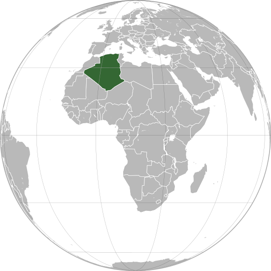
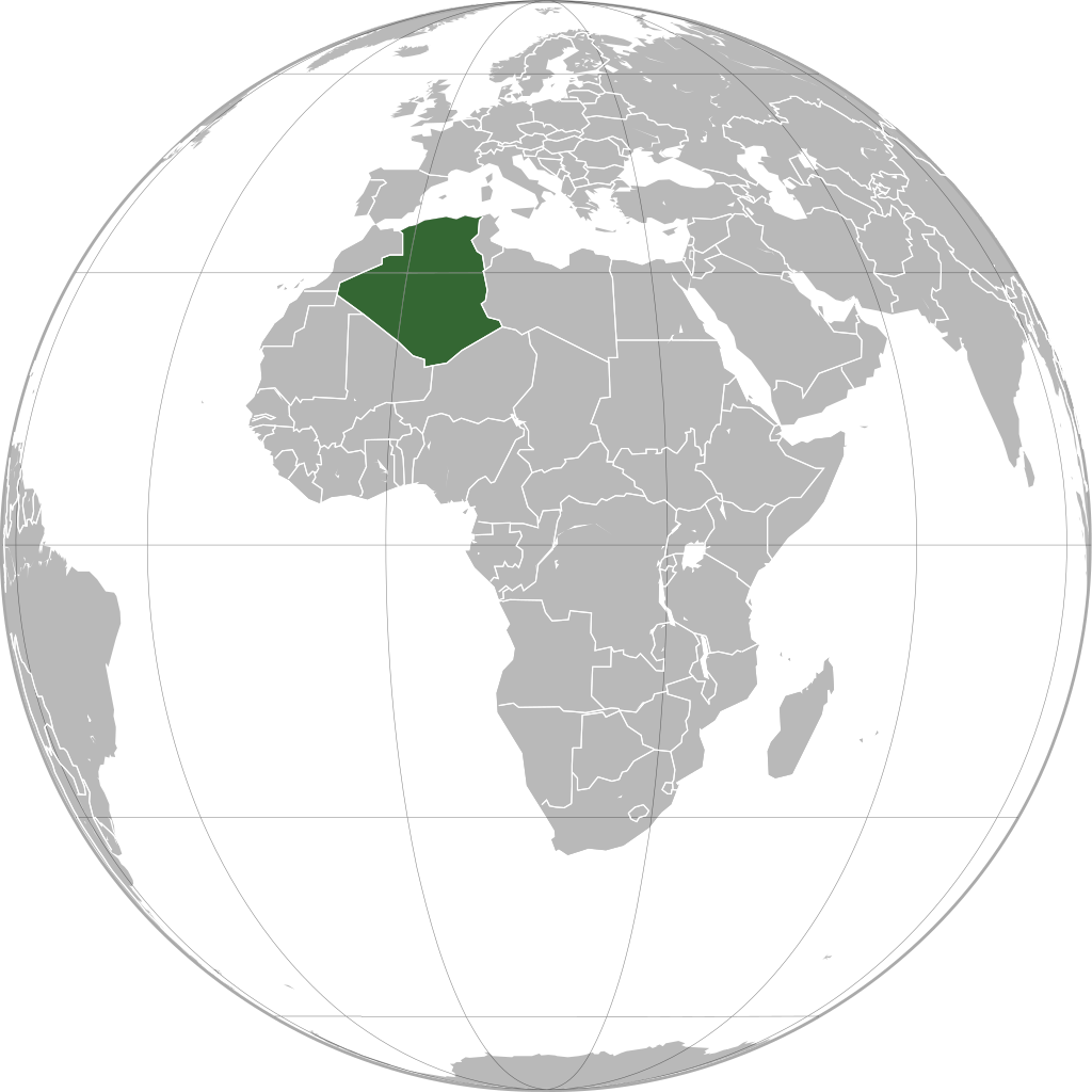
चित्र:Algeria (orthographic projection).svg

Size of this PNG preview of this SVG file: ५५० × ५५० पिक्सल. अरु संकल्पहरू: २४० × २४० पिक्सल • ४८० × ४८० पिक्सल • ७६८ × ७६८ पिक्सल • १,०२४ × १,०२४ पिक्सल • २,०४८ × २,०४८ पिक्सल।
मूल फाइल (SVG फाइल,साधारण ५५० × ५५० पिक्सेलहरु, फाइल आकार: २१८ किलोबाइटहरू)
| यो विकिमीडिया कमन्सको चित्र हो। त्यहाँ यसको विवरण पृष्ठबाट जानकारी तल देखाइएको छ। कमन्स स्वतन्त्र रूपमा इजाजतपत्र प्राप्त चित्र भण्डार हो। तपाईंले मद्दत गर्न सक्नुहुन्छ। |
.svg)
सारांश
| वर्णन |
العربية: الخريطة الهجائية للجزائر. English: Orthographic map of Algeria.
Español: Mapa ortográfico de Argelia.
Română: Harta ortogonală a Algeriei. |
| स्रोत | मेरो आफ्नै कार्य |
| लेखक | L'Américain |
अनुज्ञा प्राप्त गर्दै
| I, the copyright holder of this work, release this work into the public domain. This applies worldwide. In some countries this may not be legally possible; if so: I grant anyone the right to use this work for any purpose, without any conditions, unless such conditions are required by law. |
फाइल इतिहास
मिति/समय मा क्लिक गरेर त्यससमयमा यो फाइल कस्तो थियो भनेर हेर्न सकिन्छ ।
.svg&dir=prev)
.svg&offset=20110103131332)
.svg&offset=&limit=20)
.svg&offset=&limit=50)
.svg&offset=&limit=100)
.svg&offset=&limit=250)
.svg&offset=&limit=500)
| मिति/समय | छोटो चित्र | आकारहरू | प्रयोगकर्ता | टिप्पणी | |
|---|---|---|---|---|---|
| हालको | २३:०७, २७ डिसेम्बर २०२२ | | ५५०×५५० (२१८ किलोबाइटहरू) | M.Bitton | Reverted to version as of 13:25, 1 March 2021 (UTC): per COM:OVERWRITE + a centered version already exists |
| २०:२६, २४ डिसेम्बर २०२२ |  | २,०४८×२,०४८ (१.२५ मेगाबाइटहरू) | Takiva | . | |
| १९:१०, १ मार्च २०२१ |  | ५५०×५५० (२१८ किलोबाइटहरू) | Trần Nguyễn Minh Huy | Reverted to version as of 13:22, 2 April 2013 (UTC) missing South Sudan | |
| १३:१६, २८ फेब्रुअरी २०२१ |  | ५५०×५५० (२८१ किलोबाइटहरू) | Trần Nguyễn Minh Huy | fix scheme | |
| १९:०७, २ अप्रिल २०१३ |  | ५५०×५५० (२१८ किलोबाइटहरू) | Chipmunkdavis | Fixing Moldova, Lebanon, Israel, deleting extra layer of borders | |
| ०२:३२, ४ फेब्रुअरी २०१३ |  | ५५०×५५० (१८६ किलोबाइटहरू) | Chipmunkdavis | Removing solid fill from the borders so the lakes can be seen | |
| १०:१६, ७ अप्रिल २०१२ |  | ५५०×५५० (१८६ किलोबाइटहरू) | Chipmunkdavis | Egyptian and Kenyan administrative borders | |
| २१:५५, १४ सेप्टेम्बर २०११ |  | ५५०×५५० (१८६ किलोबाइटहरू) | Chipmunkdavis | Centreing | |
| १६:५३, १२ जुलाई २०११ |  | ५५०×५५० (१८७ किलोबाइटहरू) | Marquinhos | Added border Sudan-South Sudan. | |
| १८:५८, ३ जनवरी २०११ |  | ५५०×५५० (२८१ किलोबाइटहरू) | Martin H. | Reverted to version as of 22:15, 13 January 2010 |
फाइल प्रयोग
यस फाइलमा निम्न पृष्ठ जोडिन्छ:
विश्वव्यापी फाइल प्रयोग
निम्न अन्य विकिहरूमा यस फाइलको प्रयोग:
- ace.wikipedia.org मा उपयोग
- af.wikipedia.org मा उपयोग
- ami.wikipedia.org मा उपयोग
- ar.wikipedia.org मा उपयोग
- avk.wikipedia.org मा उपयोग
- azb.wikipedia.org मा उपयोग
- az.wiktionary.org मा उपयोग
- bg.wikipedia.org मा उपयोग
- bh.wikipedia.org मा उपयोग
- bi.wikipedia.org मा उपयोग
- bn.wikipedia.org मा उपयोग
- bug.wikipedia.org मा उपयोग
- ca.wikipedia.org मा उपयोग
- cbk-zam.wikipedia.org मा उपयोग
- cdo.wikipedia.org मा उपयोग
- ceb.wikipedia.org मा उपयोग
- chr.wikipedia.org मा उपयोग
- cs.wikipedia.org मा उपयोग
- dag.wikipedia.org मा उपयोग
- da.wikipedia.org मा उपयोग
- da.wiktionary.org मा उपयोग
- en.wikipedia.org मा उपयोग
- en.wikinews.org मा उपयोग
- en.wiktionary.org मा उपयोग
- es.wikipedia.org मा उपयोग
- fr.wikipedia.org मा उपयोग
- gcr.wikipedia.org मा उपयोग
- gu.wikipedia.org मा उपयोग
- gv.wikipedia.org मा उपयोग
- hak.wikipedia.org मा उपयोग
- hi.wikipedia.org मा उपयोग
- hr.wikipedia.org मा उपयोग
- hy.wikipedia.org मा उपयोग
- id.wikipedia.org मा उपयोग
- ie.wikipedia.org मा उपयोग
यस फाइलको विश्वव्यापी उपयोगको अधिक जानकारी हेर्नुहोस् ।
.svg)
.svg)