
चित्र:Bikini Atoll 2001-01-14, Landsat 7 ETM+, bands 3-2-1-8.png

यस पूर्व रुपको आकार: ८०० × ५०८ पिक्सल। अरु संकल्पहरू: ३२० × २०३ पिक्सल • ६४० × ४०६ पिक्सल • १,०२४ × ६५० पिक्सल • १,२८० × ८१२ पिक्सल • ३,०६३ × १,९४४ पिक्सल।
मूल फाइल (३,०६३ × १,९४४ पिक्सेलहरू, फाइल आकार: ९.९९ मेगाबाइटहरू, MIME प्रकार: image/png)
| यो विकिमीडिया कमन्सको चित्र हो। त्यहाँ यसको विवरण पृष्ठबाट जानकारी तल देखाइएको छ। कमन्स स्वतन्त्र रूपमा इजाजतपत्र प्राप्त चित्र भण्डार हो। तपाईंले मद्दत गर्न सक्नुहुन्छ। |
सारांश
| वर्णन |
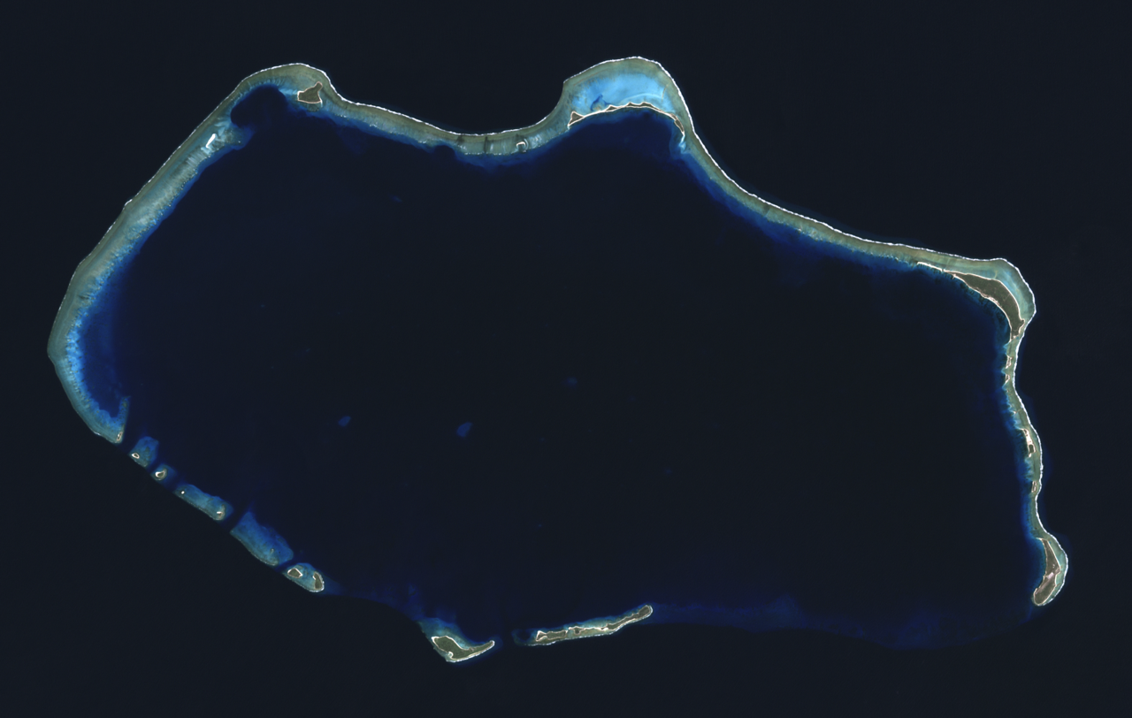
English: Composite "true color" multispectral satellite image of Bikini Atoll, Marshall Islands.
NASA Landsat 7 ETM+ bands used were 3 (red), 2 (green) and 1 (blue), and the image was pan-sharpened to 15m resolution. Imagery courtesy of NASA/USGS. |
| मिति | |
| स्रोत | NASA Landsat satellite image GeoTIFF archive, http://glovis.usgs.gov |
| लेखक | NASA |
| Camera location | | View this and other nearby images on: OpenStreetMap |
|---|
अनुज्ञा प्राप्त गर्दै
| This file is in the public domain in the United States because it was solely created by NASA. NASA copyright policy states that "NASA material is not protected by copyright unless noted". (See Template:PD-USGov, NASA copyright policy page or JPL Image Use Policy.) | ||
 |
Warnings:
|
| Annotations | This image is annotated: View the annotations at Commons |
फाइल इतिहास
मिति/समय मा क्लिक गरेर त्यससमयमा यो फाइल कस्तो थियो भनेर हेर्न सकिन्छ ।
| मिति/समय | छोटो चित्र | आकारहरू | प्रयोगकर्ता | टिप्पणी | |
|---|---|---|---|---|---|
| हालको | १०:०७, २४ सेप्टेम्बर २०१२ | | ३,०६३×१,९४४ (९.९९ मेगाबाइटहरू) | Разрывные | User created page with UploadWizard |
फाइल प्रयोग
यस फाइलमा निम्न पृष्ठ जोडिन्छ:
विश्वव्यापी फाइल प्रयोग
निम्न अन्य विकिहरूमा यस फाइलको प्रयोग:
- af.wikipedia.org मा उपयोग
- ar.wikipedia.org मा उपयोग
- ast.wikipedia.org मा उपयोग
- bn.wikivoyage.org मा उपयोग
- ca.wikipedia.org मा उपयोग
- ceb.wikipedia.org मा उपयोग
- cs.wikipedia.org मा उपयोग
- cy.wikipedia.org मा उपयोग
- de.wikivoyage.org मा उपयोग
- el.wikivoyage.org मा उपयोग
- en.wikipedia.org मा उपयोग
- en.wikivoyage.org मा उपयोग
- eu.wikipedia.org मा उपयोग
- fa.wikipedia.org मा उपयोग
- fa.wikivoyage.org मा उपयोग
- fr.wikipedia.org मा उपयोग
- he.wikipedia.org मा उपयोग
- hr.wikipedia.org मा उपयोग
- hu.wikipedia.org मा उपयोग
- id.wikipedia.org मा उपयोग
- ik.wikipedia.org मा उपयोग
- incubator.wikimedia.org मा उपयोग
- it.wikipedia.org मा उपयोग
- lv.wikipedia.org मा उपयोग
- ms.wikipedia.org मा उपयोग
- pl.wikipedia.org मा उपयोग
- ru.wikipedia.org मा उपयोग
- sh.wikipedia.org मा उपयोग
- sr.wikipedia.org मा उपयोग
- tr.wikipedia.org मा उपयोग
- uk.wikipedia.org मा उपयोग
- ur.wikipedia.org मा उपयोग
- vi.wikipedia.org मा उपयोग
- www.wikidata.org मा उपयोग
- zh.wikivoyage.org मा उपयोग