
चित्र:Colombia location map.svg

Size of this PNG preview of this SVG file: ५१२ × ५७९ पिक्सल. अरु संकल्पहरू: २१२ × २४० पिक्सल • ४२४ × ४८० पिक्सल • ६७९ × ७६८ पिक्सल • ९०५ × १,०२४ पिक्सल • १,८११ × २,०४८ पिक्सल।
मूल फाइल (SVG फाइल,साधारण ५१२ × ५७९ पिक्सेलहरु, फाइल आकार: १.०७ मेगाबाइटहरू)
| यो विकिमीडिया कमन्सको चित्र हो। त्यहाँ यसको विवरण पृष्ठबाट जानकारी तल देखाइएको छ। कमन्स स्वतन्त्र रूपमा इजाजतपत्र प्राप्त चित्र भण्डार हो। तपाईंले मद्दत गर्न सक्नुहुन्छ। |
सारांश
| वर्णन |
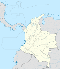
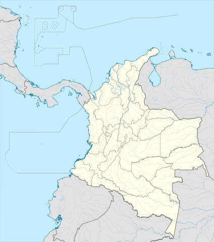
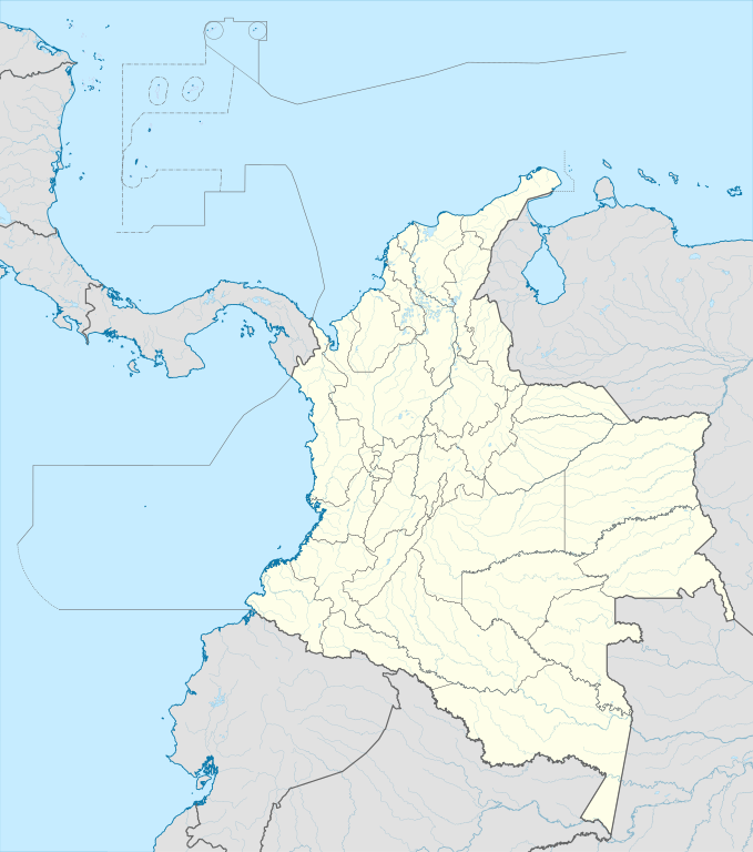
English: Location map of Colombia
Equirectangular projection. Geographic limits of the map:
|
| मिति | |
| स्रोत | मेरो आफ्नै कार्य (Original text: own work, using Demis data) |
| लेखक | Milenioscuro |
| अरु संस्करणहरू |
Derivative works of this file: Bajo Nuevo Colombia location.png
|
| SVG genesis | This W3C-invalid map was created with Adobe Illustrator. |


.svg)

अनुज्ञा प्राप्त गर्दै
Milenioscuro, the copyright holder of this work, hereby publishes it under the following license:
यो फाइल क्रिएटिभ कमन्स एट्रिब्युसन-सेयर एलाइक ३.० अनपोर्टेड लाइसेन्स अनुसारको अनुमति प्राप्त छ।
एट्रिब्युसन: Milenioscuro
- तपाईं स्वतन्त्र हुनुहुन्छ :
- साझेदारी गर्नुहाेस् – रचनालाई कपी, वितरित तथा संचारित गर्नको लागि
- रिमिक्स गर्नको लागि – काम अनुकूलित गर्नको लागि
- निम्नलिखित कारणहरूको अन्तर्गत:
- एट्रिब्युसन – तपाईंले रचनाको श्रेय अनुमतिपत्रकर्ता अथवा लेखकले बताएको माध्यमले दिनु पर्नेछ (तर यस प्रकार हैन, जसमा लागोस् की उ तपाईंलाई अथवा तपाईंको रचनाको प्रयोगलाई समर्थन गर्छन्)।
- शेयर अलाइक – यदि तपाई यस रचनामा कुनै परिवर्तन अथवा संसोधन गर्नुहुन्छ या यसमा आधारित केही रचना गर्नुहुन्छ भने तपाई निष्कर्ष स्वरूप बनेको रचनालाई मात्र यहाँ अथवा यसको समान कुनै अनिमति पत्र अन्तर्गत वितरित गर्न सक्नुहुन्छ।
| Annotations | This image is annotated: View the annotations at Commons |


फाइल इतिहास
मिति/समय मा क्लिक गरेर त्यससमयमा यो फाइल कस्तो थियो भनेर हेर्न सकिन्छ ।
| मिति/समय | छोटो चित्र | आकारहरू | प्रयोगकर्ता | टिप्पणी | |
|---|---|---|---|---|---|
| हालको | ०२:०२, २३ फेब्रुअरी २०२२ | | ५१२×५७९ (१.०७ मेगाबाइटहरू) | Milenioscuro | standard colors |
| १६:५५, १ डिसेम्बर २०१७ |  | २,०२७×२,२९४ (१.३७ मेगाबाइटहरू) | Milenioscuro | limits | |
| १६:४५, १ डिसेम्बर २०१७ |  | २,०२७×२,२९४ (१.३७ मेगाबाइटहरू) | Milenioscuro | more visible limits | |
| ११:३३, २८ जनवरी २०१४ |  | २,०२७×२,२९४ (१.३९ मेगाबाइटहरू) | Milenioscuro | correction of departamental, international and maritime boundaries, courses of rivers, coastline, and line thickness | |
| २२:४६, २९ मे २०१२ |  | २,००७×२,२९८ (१.०७ मेगाबाइटहरू) | Milenioscuro | correction of some departamental borders | |
| ००:४३, २७ मार्च २०१२ |  | २,००७×२,२९८ (१.०८ मेगाबाइटहरू) | Milenioscuro | correction of international borders, added layers, rivers, etc | |
| १३:५७, १७ नोभेम्बर २०११ |  | २,००७×२,२९८ (१.०४ मेगाबाइटहरू) | Milenioscuro | simplification of rivers, correction of some borders | |
| ०५:३३, ३ नोभेम्बर २००९ |  | २,००७×२,२९८ (१.१४ मेगाबाइटहरू) | Milenioscuro | thick boundaries of departments | |
| १४:५५, १ नोभेम्बर २००९ |  | २,००७×२,२९८ (१.१५ मेगाबाइटहरू) | Milenioscuro | Adjusted to match style of location maps 2008 | |
| १३:१५, २६ अक्टोबर २००९ |  | २,२६८×२,६७६ (१.४ मेगाबाइटहरू) | Milenioscuro | maritime boundaries |
फाइल प्रयोग
यस फाइलमा निम्न पृष्ठ जोडिन्छ:
विश्वव्यापी फाइल प्रयोग
निम्न अन्य विकिहरूमा यस फाइलको प्रयोग:
- af.wikipedia.org मा उपयोग
- als.wikipedia.org मा उपयोग
- an.wikipedia.org मा उपयोग
- ar.wikipedia.org मा उपयोग
- ast.wikipedia.org मा उपयोग
- Bogotá
- Cali
- Estadiu Doce de Octubre
- Puerto Colombia (Guainía)
- González (Cesar)
- Estadiu Deportivo Cali
- Módulu:Mapa de llocalización/datos/Colombia
- Ríu Magdalena
- Capitoliu Nacional de Colombia
- Comisión Colombiana del Espaciu
- Nevado del Ruiz
- Módulu:Mapa de llocalización/datos/Colombia/usu
- Barranquilla
- Cartagena de Indias
- Estadiu Metropolitanu Roberto Meléndez
- Palenque de San Basilio
- Copa América 2001
- Sierra de Chiribiquete
- Inírida
- Aeropuertu Internacional El Dorado
- Casa d'Adoración Norte del Cauca
- Aeropuertu Guaymaral
- Aeropuertu Internacional Alfonso Bonilla Aragón
- Aeropuertu Internacional Alfredo Vásquez Cobo
- Aeropuertu Internacional Camilo Daza
- Aeropuertu Internacional El Edén
- Aeropuertu Internacional Ernesto Cortissoz
- Aeropuertu Internacional Gustavo Rojas Pinilla
- Aeropuertu Internacional José María Córdova
- Aeropuertu Internacional Matecaña
यस फाइलको विश्वव्यापी उपयोगको अधिक जानकारी हेर्नुहोस् ।