
चित्र:Nepal Bagmati rel location map.svg

मूल फाइल (SVG फाइल,साधारण ७३३ × ४९० पिक्सेलहरु, फाइल आकार: १.२४ मेगाबाइटहरू)
| यो विकिमीडिया कमन्सको चित्र हो। त्यहाँ यसको विवरण पृष्ठबाट जानकारी तल देखाइएको छ। कमन्स स्वतन्त्र रूपमा इजाजतपत्र प्राप्त चित्र भण्डार हो। तपाईंले मद्दत गर्न सक्नुहुन्छ। |
सारांश
| वर्णन |
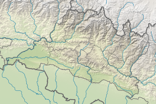
Deutsch: Positionskarte von Bagmati Pradesh, Nepal
English: Location map of Bagmati Pradesh, Nepal
|
||||||||||||
| मिति | |||||||||||||
| स्रोत |
Own work using:
|
||||||||||||
| लेखक | NordNordWest | ||||||||||||
| अरु संस्करणहरू |
|
||||||||||||


|
This map has been made or improved in the German Kartenwerkstatt (Map Lab). You can propose maps to improve as well.
|
अनुज्ञा प्राप्त गर्दै
Usage of this file with:

explanatory notes: Legally binding is only the full legalcode. For a free usage I recommend to respect the following licence conditions:
1. Provide my name as given above: NordNordWest,
2. a copy of, or the URI for, the applicable license: https://creativecommons.org/licenses/by-sa/3.0/de/legalcode,
3. the title of the work,
4. in the case of an adaptation, a credit identifying the use of the work in the adaptation.
This license and the rights granted hereunder will terminate automatically upon any breach by you of the terms of this license. Any of the above conditions can be waived if you get permission from the copyright holder. If you have questions or wish differing conditions, please contact me through nnwest or my discussion page ![]() t-online.de
t-online.de
- तपाईं स्वतन्त्र हुनुहुन्छ :
- साझेदारी गर्नुहाेस् – रचनालाई कपी, वितरित तथा संचारित गर्नको लागि
- रिमिक्स गर्नको लागि – काम अनुकूलित गर्नको लागि
- निम्नलिखित कारणहरूको अन्तर्गत:
- एट्रिब्युसन – तपाईंले रचनाको श्रेय अनुमतिपत्रकर्ता अथवा लेखकले बताएको माध्यमले दिनु पर्नेछ (तर यस प्रकार हैन, जसमा लागोस् की उ तपाईंलाई अथवा तपाईंको रचनाको प्रयोगलाई समर्थन गर्छन्)।
- शेयर अलाइक – यदि तपाई यस रचनामा कुनै परिवर्तन अथवा संसोधन गर्नुहुन्छ या यसमा आधारित केही रचना गर्नुहुन्छ भने तपाई निष्कर्ष स्वरूप बनेको रचनालाई मात्र यहाँ अथवा यसको समान कुनै अनिमति पत्र अन्तर्गत वितरित गर्न सक्नुहुन्छ।

फाइल इतिहास
मिति/समय मा क्लिक गरेर त्यससमयमा यो फाइल कस्तो थियो भनेर हेर्न सकिन्छ ।
| मिति/समय | छोटो चित्र | आकारहरू | प्रयोगकर्ता | टिप्पणी | |
|---|---|---|---|---|---|
| हालको | २०:१५, ४ डिसेम्बर २०१९ | | ७३३×४९० (१.२४ मेगाबाइटहरू) | NordNordWest | == {{int:filedesc}} == {{Information |description= {{de|1=Positionskarte von Provinz Nr. 3, Nepal}} {{en|1=Location map of Province No. 3, Nepal}} {{Location map series N |stretching=114 |top=28.5 |bottom=26.8 |left=83.8 |right=86.7 }} |source={{Own using}} * United States National Imagery and Mapping Agency data * SRTM3 data |date=2019-12-04 |author={{U|NordNordWest}} |permission= |other_versions=<gallery>Nepal Province No 3 adm location map.svg</gallery> }} {{Kartenwerkstatt}} == {{int:lic... |
फाइल प्रयोग
यस फाइलमा निम्न 10 पृष्ठहरू जोडिन्छन्:
विश्वव्यापी फाइल प्रयोग
निम्न अन्य विकिहरूमा यस फाइलको प्रयोग:
- ban.wikipedia.org मा उपयोग
- bcl.wikipedia.org मा उपयोग
- bn.wikipedia.org मा उपयोग
- de.wikipedia.org मा उपयोग
- Gauri Sankar
- Wikipedia:Kartenwerkstatt/Positionskarten/Asien
- Takargo
- Langtang Lirung
- Baden-Powell Peak
- Dorje Lhakpa
- Yala Peak
- Dragmarpo Ri
- Naya Kanga
- Kimshung
- Gangchempo
- Langtang Ri
- Pabil
- Salasungo
- Paldor
- Langshisa Ri
- Loenpo Gang
- Parchamo
- Ramdung Go
- Chekigo
- Tengi Ragi Tau
- Numbur
- Likhu Chuli
- Kang Nachugo
- Drangnag Ri
- Tsho Rolpa
- Chugimago
- Gurkarpo Ri
- Pemthang Karpo Ri
- Ganesh V
- Talsperre Kulekhani
- Tashi Lapcha
- Trakardinggletscher
- Drolambaogletscher
- Tsoboje
- Yalung Ri
- Vorlage:Positionskarte Nepal Bagmati
- Kailashnath-Mahadev-Statue
- en.wikipedia.org मा उपयोग
यस फाइलको विश्वव्यापी उपयोगको अधिक जानकारी हेर्नुहोस् ।