"बोलिभिया" का संशोधनहरू बिचको अन्तर
Content deleted Content added
सा रोबोट ले थप्दै {{Commonscat|Bolivia}} |
सा fixing dead links |
||
| पङ्क्ति १६: | पङ्क्ति १६: | ||
| alt_map2 = |
| alt_map2 = |
||
| map_caption2 = |
| map_caption2 = |
||
| capital = [[Sucre]] (constitutional capital)<ref>[http://www.presidencia.gob.bo/download/constitucion.pdf "Artículo 6. I. Sucre es la Capital de Bolivia."] (Article 6. I. Sucre is the capital of Bolivia.) [http://www.presidencia.gob.bo/download/constitucion.pdf Constitution of Bolivia]</ref><ref name="CIA - The World Factbook">[https://www.cia.gov/library/publications/the-world-factbook/geos/bl.html CIA - The World Factbook]</ref><br/><small>{{Coord|19|2|S|65|15|W}}</small><br>[[La Paz]] (administrative capital)<ref name="CIA - The World Factbook"/><br/><small>{{Coord|16|30|S|68|09|W}}</small> |
| capital = [[Sucre]] (constitutional capital)<ref>[http://web.archive.org/web/20090521023641/http://www.presidencia.gob.bo/download/constitucion.pdf "Artículo 6. I. Sucre es la Capital de Bolivia."] (Article 6. I. Sucre is the capital of Bolivia.) [http://web.archive.org/web/20090521023641/http://www.presidencia.gob.bo/download/constitucion.pdf Constitution of Bolivia]</ref><ref name="CIA - The World Factbook">[https://www.cia.gov/library/publications/the-world-factbook/geos/bl.html CIA - The World Factbook]</ref><br/><small>{{Coord|19|2|S|65|15|W}}</small><br>[[La Paz]] (administrative capital)<ref name="CIA - The World Factbook"/><br/><small>{{Coord|16|30|S|68|09|W}}</small> |
||
| largest_city = {{nowrap|[[Santa Cruz de la Sierra]]}}<br/><small>{{Coord|17|48|S|63|10|W}} |
| largest_city = {{nowrap|[[Santa Cruz de la Sierra]]}}<br/><small>{{Coord|17|48|S|63|10|W}} |
||
| official_languages = [[Spanish language|Spanish]] <br />[[Quechua language|Quechua]] <br />[[Aymara language|Aymara]] <br /> and 34 other native languages<ref>[http://www.presidencia.gob.bo/asamblea/nueva_cpe_aprobada_en_grande_en_detalle_y_en_revision.pdf Bolivian Constitution], Article 5-I: ''Son idiomas oficiales del Estado el castellano y todos los idiomas de las naciones y pueblos indígena originario campesinos, que son el [[Aymara language|aymara]], [[araona]], [[baure language|baure]], [[Chiquitano language|bésiro]], [[Canichana language|canichana]], [[Cavineña|cavineño]], [[Cayubaba language|cayubaba]], [[Chácobo language|chácobo]], [[Chimán language|chimán]], [[ese ejja]], [[Guarani language|Guaraní]], [[guarasu'we]], [[guarayu]], [[Itonama language|itonama]], [[leco language|leco]], [[Kallawaya language|machajuyai-kallawaya]], [[Machiguenga|machineri]], [[Reyesano language|maropa]], [[Moxos|mojeño-trinitario]], [[Moxos|mojeño-ignaciano]], [[moré language (Bolivia)|moré]], [[Tsimane'|mosetén]], [[Movima language|movima]], [[Pacaquuara language|pacawara]], [[Puquina language|puquina]], [[Quechua languages|quechua]], [[Sirionó language|sirionó]], [[tacana]], [[tapieté]], [[toromona]], [[Uru language|uru-chipaya]], [[Wichí Lhamtés Nocten|weenhayek]], [[yawanawa]], yuki, [[yuracaré]] y [[Ayoreo language|zamuco]].''</ref><ref>{{cite web|url=http://kids.britannica.com/comptons/atlas?geogId=31 |title=Kids Encyclopedia |publisher=Kids.britannica.com |date=8 February 2009 |accessdate=30 August 2010}}</ref> |
| official_languages = [[Spanish language|Spanish]] <br />[[Quechua language|Quechua]] <br />[[Aymara language|Aymara]] <br /> and 34 other native languages<ref>[http://web.archive.org/web/20081215222103/http://www.presidencia.gob.bo/asamblea/nueva_cpe_aprobada_en_grande_en_detalle_y_en_revision.pdf Bolivian Constitution], Article 5-I: ''Son idiomas oficiales del Estado el castellano y todos los idiomas de las naciones y pueblos indígena originario campesinos, que son el [[Aymara language|aymara]], [[araona]], [[baure language|baure]], [[Chiquitano language|bésiro]], [[Canichana language|canichana]], [[Cavineña|cavineño]], [[Cayubaba language|cayubaba]], [[Chácobo language|chácobo]], [[Chimán language|chimán]], [[ese ejja]], [[Guarani language|Guaraní]], [[guarasu'we]], [[guarayu]], [[Itonama language|itonama]], [[leco language|leco]], [[Kallawaya language|machajuyai-kallawaya]], [[Machiguenga|machineri]], [[Reyesano language|maropa]], [[Moxos|mojeño-trinitario]], [[Moxos|mojeño-ignaciano]], [[moré language (Bolivia)|moré]], [[Tsimane'|mosetén]], [[Movima language|movima]], [[Pacaquuara language|pacawara]], [[Puquina language|puquina]], [[Quechua languages|quechua]], [[Sirionó language|sirionó]], [[tacana]], [[tapieté]], [[toromona]], [[Uru language|uru-chipaya]], [[Wichí Lhamtés Nocten|weenhayek]], [[yawanawa]], yuki, [[yuracaré]] y [[Ayoreo language|zamuco]].''</ref><ref>{{cite web|url=http://kids.britannica.com/comptons/atlas?geogId=31 |title=Kids Encyclopedia |publisher=Kids.britannica.com |date=8 February 2009 |accessdate=30 August 2010}}</ref> |
||
| ethnic_groups = 55% [[Amerindian]]<br>([[Quechua people|Quechua]], [[Aymara people|Aymara]]<br>and 34 other ethnic groups)<br>30% [[Mestizo]]<br>15% [[White Latin American|White]]<ref name="cia">{{cite web|url=https://www.cia.gov/library/publications/the-world-factbook/geos/bl.html|title=The World Factbook – Bolivia|publisher=CIA|accessdate=30 March 2010}}</ref> |
| ethnic_groups = 55% [[Amerindian]]<br>([[Quechua people|Quechua]], [[Aymara people|Aymara]]<br>and 34 other ethnic groups)<br>30% [[Mestizo]]<br>15% [[White Latin American|White]]<ref name="cia">{{cite web|url=https://www.cia.gov/library/publications/the-world-factbook/geos/bl.html|title=The World Factbook – Bolivia|publisher=CIA|accessdate=30 March 2010}}</ref> |
||
| demonym = Bolivian |
| demonym = Bolivian |
||
०४:२३, २७ अगस्ट २०१४ जस्तै गरी पुनरावलोकन
Plurinational State of Bolivia | |
|---|---|
 | |
| राजधानी | Sucre (constitutional capital)[३][४] १९°२′द॰ ६५°१५′प॰ / १९.०३३°S ६५.२५०°W La Paz (administrative capital)[४] १६°३०′द॰ ६८°०९′प॰ / १६.५००°S ६८.१५०°W |
| सबैभन्दा ठुलो सहर | Santa Cruz de la Sierra १७°४८′द॰ ६३°१०′प॰ / १७.८००°S ६३.१६७°W |
| आधिकारिक भाषाहरू | Spanish Quechua Aymara and 34 other native languages[५][६] |
| जातिगत समूहहरू | 55% Amerindian (Quechua, Aymara and 34 other ethnic groups) 30% Mestizo 15% White[७] |
| रैथाने(हरू) | Bolivian |
| सरकार | Unitary Presidential Republic |
| Evo Morales | |
| Álvaro García | |
| Independence from स्पेन | |
• Declared | 6 August 1825 |
• Recognized | 21 July 1847 |
February 7, 2009 | |
| क्षेत्रफल | |
• जम्मा | १०,९८,५८१ किमी२ (४,२४,१६४ वर्ग माइल) (28th) |
• पानी (%) | 1.29 |
| जनसङ्ख्या | |
• 2010 अनुमानित | |
• 2001 जनगणना | 8,280,184 |
• घनत्व | ८.९ /किमी2 (२३.१ /वर्ग माइल) (220th) |
| कुल ग्राहस्थ उत्पादन (क्रय शक्ति समता) | 2010 लगत |
• जम्मा | $47.882 billion[९] |
• प्रति व्यक्ति | $4,592[९] |
| कुल ग्राहस्थ उत्पादन (साङ्केतिक) | 2011 लगत |
• जम्मा | $22.778 billion[९] |
• प्रति व्यक्ति | $2,143[९] |
| गिनी (2009) | 58.2[१०] त्रुटि: अमान्य गिनी मान |
| मानव विकास सूचकाङ्क (2011) | त्रुटि: अमान्य एचडिआई मान · 108th |
| मुद्रा | Boliviano (BOB) |
| समय क्षेत्र | अन्तर्राष्ट्रिय प्रमाणिक समय-4 |
| सडक प्रयोग | right |
| टेलिफोन कोड | +591 |
| इन्टरनेट डोमेन | .bo |
परिचय
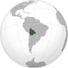
बोलिभिया(स्पेनिस: [boliˈβja]) आधिकारिक रूपमा प्लुरिनेशनल स्टेट अफ बोलिभिया मध्य दक्षिण अमेरिकि भुपरिवेष्ठित मुलुक हो। यो देश दक्षिण अमेरिकाको सबैभन्दा गरीब राष्ट्र पनि हो। यसको पुर्व र उत्तरमा ब्राजिल, दक्षिणमा पाराग्वे र अर्जेन्टिना, दक्षिण पश्चिममा चिले र पश्चिममा पेरु रहेका छन्। यो देशको राजधानी लापाज र सुकर हुन्। यहाँको मुख्य भाषा स्पेनिस हो।
Sánchez de Lozada and Banzer: देश लाई उदार गराउने

भुगोल
| Territorial division of Bolivia | ||||||
| Department | Abbreviation (ISO) |
Population | Surface (km²) | Density | Capital city | 
|
|---|---|---|---|---|---|---|
| BO | 10.027.644 | 1.098.581 | 9,1 | Sucre (Constitutional) Nuestra Señora de La Paz (Administrative) | ||
| BO-B | 430.049 | 213.564 | 1,9 | Trinidad | ||
| BO-H | 631.062 | 51.524 | 11,9 | Sucre | ||
| BO-C | 1.786.040 | 55.631 | 22,7 | Cochabamba | ||
| BO-L | 2.756.989 | 133.985 | 19,9 | La Paz | ||
| BO-O | 444.093 | 53.558 | 8,2 | Oruro | ||
| BO-N | 75.335 | 63.827 | 1,1 | Cobija | ||
| BO-P | 780.392 | 118.218 | 6,5 | Potosí | ||
| BO-S | 2.626.697 | 370.621 | 7,1 | Santa Cruz de la Sierra | ||
| BO-T | 496.988 | 37.623 | 12,5 | Tarija | ||
| Source: Demographic Projections 2008, Bolivian National Demographic Institute.[१२] The departmental densitiy has been calculated with the population of 2006. | ||||||
| Fauna and Flora of Bolivia | |||||||

|

|

|

|
||||
| Leopardus pardalis Ocelot |
Saimiri boliviensis Black-capped squirrel monkey |
Phoenicopterus andinus Andean Flamingo |
Lama glama Llama |
Inia boliviensis Amazon river dolphin | |||

|

|

|

| ||||
| Heliconia rostrata Patujú |
Echinopsis boyuibensis Boyuibe cactus |
Ceiba speciosa Toborochi |
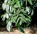
Swietenia macrophylla Mara |
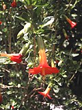
Cantua buxifolia Cantuta | |||
Territorial limits
| Boundaries | |||
 | |||
| Country | Terrestrial | Maritime | Total |
|---|---|---|---|
| 471 | 302 | 773 | |
| 750 | 2.673¹ | 3.423 | |
| 830 | 20 | 850 | |
| 634 | 57 | 741 | |
| 513 | 534² | 1.047 | |
| Terrestrial | 3.469 | ||
| Maritime | 3.579 | ||
| Total | 6.834 | ||
| Notes:
1 =From the 2.673 kilometers of maritime boundaries with Brazil, 95 kilometers are lakes, being the rest rivers. | |||

ईतिहाँस


राजनिति र प्रशासन
सन्दर्भ सामाग्रीहरू
- ↑ "Central Bank of Bolivia", The Bolivian coin, अन्तिम पहुँच २००६-०८-०४।
- ↑ Article 6, section II of the new Bolivian constitution establishes the Wiphala as a national symbol of Bolivia (along with the flag, national anthem and coat of arms). See "Bandera indígena boliviana es incluida como símbolo patrio en nueva Constitución", October 21, 2008, United Press International.
- ↑ "Artículo 6. I. Sucre es la Capital de Bolivia." (Article 6. I. Sucre is the capital of Bolivia.) Constitution of Bolivia
- ↑ ४.० ४.१ CIA - The World Factbook
- ↑ Bolivian Constitution, Article 5-I: Son idiomas oficiales del Estado el castellano y todos los idiomas de las naciones y pueblos indígena originario campesinos, que son el aymara, araona, baure, bésiro, canichana, cavineño, cayubaba, chácobo, chimán, ese ejja, Guaraní, guarasu'we, guarayu, itonama, leco, machajuyai-kallawaya, machineri, maropa, mojeño-trinitario, mojeño-ignaciano, moré, mosetén, movima, pacawara, puquina, quechua, sirionó, tacana, tapieté, toromona, uru-chipaya, weenhayek, yawanawa, yuki, yuracaré y zamuco.
- ↑ "Kids Encyclopedia", Kids.britannica.com, ८ फेब्रुअरी २००९, अन्तिम पहुँच ३० अगस्ट २०१०।
- ↑ "The World Factbook – Bolivia", CIA, अन्तिम पहुँच ३० मार्च २०१०।
- ↑ "Bolivia", World Gazetteer, मूलबाट १९ जनवरी २०१३-मा सङ्ग्रहित, अन्तिम पहुँच ७ जनवरी २०१०।
- ↑ ९.० ९.१ ९.२ ९.३ "Bolivia", International Monetary Fund, अन्तिम पहुँच ८ डिसेम्बर २०११।
- ↑ "Distribution of family income – Gini index", The World Factbook, CIA, अन्तिम पहुँच ३१ अगस्ट २०११।
- ↑ "Human Development Report 2010", United Nations, २०११, अन्तिम पहुँच ९ नोभेम्बर २०११।
- ↑ [१]
विकिमिडिया कमन्समा बोलिभिया सम्बन्धी अन्य सामग्रीहरू रहेका छन्।


