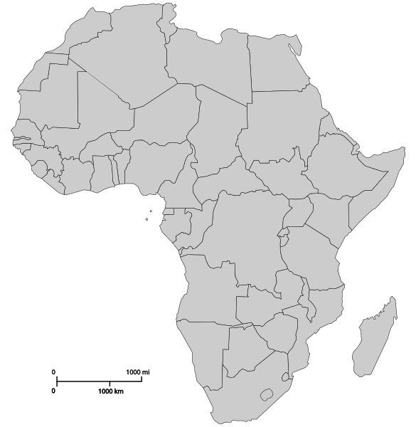
चित्र:Blank Map-Africa.svg

Size of this PNG preview of this SVG file: ५८५ × ६०० पिक्सल. अरु संकल्पहरू: २३४ × २४० पिक्सल • ४६८ × ४८० पिक्सल • ७४९ × ७६८ पिक्सल • ९९९ × १,०२४ पिक्सल • १,९९८ × २,०४८ पिक्सल • १,२०० × १,२३० पिक्सल।
मूल फाइल (SVG फाइल,साधारण १,२०० × १,२३० पिक्सेलहरु, फाइल आकार: ५४ किलोबाइटहरू)
फाइल इतिहास
मिति/समय मा क्लिक गरेर त्यससमयमा यो फाइल कस्तो थियो भनेर हेर्न सकिन्छ ।
| मिति/समय | छोटो चित्र | आकारहरू | प्रयोगकर्ता | टिप्पणी | |
|---|---|---|---|---|---|
| हालको | ०४:३७, ९ मार्च २०१८ |  | १,२००×१,२३० (५४ किलोबाइटहरू) | Maphobbyist | Reverted to version as of 14:58, 20 October 2011 (UTC) |
| ०६:००, १८ जुलाई २०१७ |  | १,२००×१,२३० (६३ किलोबाइटहरू) | AVRTM2 | Reverted to version as of 08:33, 20 January 2017 (UTC) | |
| २२:३०, १३ जुलाई २०१७ |  | १,२००×१,२३० (५९ किलोबाइटहरू) | Mosahih | Minor modification | |
| २१:३५, १३ जुलाई २०१७ |  | १,२००×१,२३० (५४ किलोबाइटहरू) | Mosahih | SADR unrecognized country | |
| १४:१८, २० जनवरी २०१७ |  | १,२००×१,२३० (६३ किलोबाइटहरू) | عادل | correction of Egypt borders | |
| २०:४३, २० अक्टोबर २०११ |  | १,२००×१,२३० (५४ किलोबाइटहरू) | Ninjatacoshell | Changed Sudan from a single object with a line across it to two objects—north and south. | |
| ०१:०२, २३ जुलाई २०११ |  | १,२००×१,२३० (४७ किलोबाइटहरू) | Liandrei | +South Sudan | |
| ०५:४३, १९ मार्च २००७ |  | १,२००×१,२३० (६७ किलोबाइटहरू) | Revolus | Lesotho nach hinten, Quelle de:Bild:Afrika_Politisch_2.png | |
| ०५:२९, १९ मार्च २००७ |  | १,२००×१,२३० (६७ किलोबाइटहरू) | Revolus | Angepasst; kleiner; ordentliche IDs; leider deutsch, da zu faul, englische Namen rauszusuchen | |
| ०९:४१, ७ सेप्टेम्बर २००६ |  | १,२००×१,२३० (८५ किलोबाइटहरू) | Andreas 06 | Imagesize reduced |
फाइल प्रयोग
यो फाइलसँग कुनै पनि पृष्ठ जोडिएको छैन।
विश्वव्यापी फाइल प्रयोग
निम्न अन्य विकिहरूमा यस फाइलको प्रयोग:
- ar.wikipedia.org मा उपयोग
- azb.wikipedia.org मा उपयोग
- bg.wikipedia.org मा उपयोग
- dag.wikipedia.org मा उपयोग
- de.wikipedia.org मा उपयोग
- en.wikipedia.org मा उपयोग
- List of temples of the Church of Jesus Christ of Latter-day Saints
- Johannesburg South Africa Temple
- Aba Nigeria Temple
- Africa
- Accra Ghana Temple
- User:Lumber Jack second account
- List of temples of the Church of Jesus Christ of Latter-day Saints by geographic region
- Comparison of temples of the Church of Jesus Christ of Latter-day Saints
- Template:Africa Labelled Map
- Temple architecture (LDS Church)
- Billy Johnson (Mormon)
- Membership statistics of the Church of Jesus Christ of Latter-day Saints
- Membership statistics of the Church of Jesus Christ of Latter-day Saints (United States)
- Membership statistics of the Church of Jesus Christ of Latter-day Saints (Canada)
- The Church of Jesus Christ of Latter-day Saints in Ghana
- Temple (LDS Church)
- Template:LDS-Africa
- The Church of Jesus Christ of Latter-day Saints in the Democratic Republic of the Congo
- The Church of Jesus Christ of Latter-day Saints in Liberia
- Durban South Africa Temple
- The Church of Jesus Christ of Latter-day Saints in South Africa
- The Church of Jesus Christ of Latter-day Saints in Nigeria
- The Church of Jesus Christ of Latter-day Saints in Sierra Leone
- The Church of Jesus Christ of Latter-day Saints in Angola
- The Church of Jesus Christ of Latter-day Saints in Botswana
- The Church of Jesus Christ of Latter-day Saints in Zimbabwe
- The Church of Jesus Christ of Latter-day Saints in Uganda
- The Church of Jesus Christ of Latter-day Saints in Kenya
- The Church of Jesus Christ of Latter-day Saints in Ivory Coast
- The Church of Jesus Christ of Latter-day Saints in Cape Verde
- The Church of Jesus Christ of Latter-day Saints in Madagascar
- User:Northamerica1000/Notepad
- User:Pharaoh Amun
- Abidjan Ivory Coast Temple
- Outline of the Church of Jesus Christ of Latter-day Saints
- Harare Zimbabwe Temple
- Talk:2018 Équateur province Ebola outbreak/Archive 1
- Kinshasa Democratic Republic of the Congo Temple
- Praia Cape Verde Temple
- Bengaluru India Temple
- Template:LDS-World
- User:Mujinga/DraftT28
यस फाइलको विश्वव्यापी उपयोगको अधिक जानकारी हेर्नुहोस् ।
