
चित्र:Eyjafjallajokull Gigjokull in ash.jpg

यस पूर्व रुपको आकार: ८०० × ५३३ पिक्सल। अरु संकल्पहरू: ३२० × २१३ पिक्सल • ६४० × ४२७ पिक्सल • १,०२४ × ६८३ पिक्सल • १,२८० × ८५३ पिक्सल • २,५६० × १,७०७ पिक्सल • ४,७५२ × ३,१६८ पिक्सल।
मूल फाइल (४,७५२ × ३,१६८ पिक्सेलहरू, फाइल आकार: २.५२ मेगाबाइटहरू, MIME प्रकार: image/jpeg)
| यो विकिमीडिया कमन्सको चित्र हो। त्यहाँ यसको विवरण पृष्ठबाट जानकारी तल देखाइएको छ। कमन्स स्वतन्त्र रूपमा इजाजतपत्र प्राप्त चित्र भण्डार हो। तपाईंले मद्दत गर्न सक्नुहुन्छ। |
सारांश
| वर्णन |
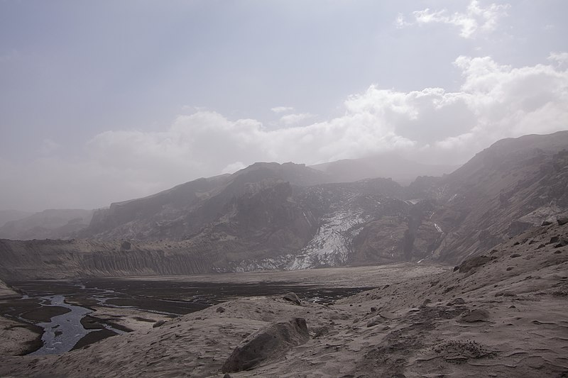
English: Gígjökull covered in ash after the 2010 eruption of Eyjafjallajökull |
| मिति | |
| स्रोत | मेरो आफ्नै कार्य |
| लेखक | Boaworm |
| Camera location | | View this and other nearby images on: OpenStreetMap |
|---|
अनुज्ञा प्राप्त गर्दै
I, the copyright holder of this work, hereby publish it under the following license:
This file is licensed under the Creative Commons Attribution 3.0 Unported license.
- तपाईं स्वतन्त्र हुनुहुन्छ :
- साझेदारी गर्नुहाेस् – रचनालाई कपी, वितरित तथा संचारित गर्नको लागि
- रिमिक्स गर्नको लागि – काम अनुकूलित गर्नको लागि
- निम्नलिखित कारणहरूको अन्तर्गत:
- एट्रिब्युसन – तपाईंले रचनाको श्रेय अनुमतिपत्रकर्ता अथवा लेखकले बताएको माध्यमले दिनु पर्नेछ (तर यस प्रकार हैन, जसमा लागोस् की उ तपाईंलाई अथवा तपाईंको रचनाको प्रयोगलाई समर्थन गर्छन्)।
फाइल इतिहास
मिति/समय मा क्लिक गरेर त्यससमयमा यो फाइल कस्तो थियो भनेर हेर्न सकिन्छ ।
| मिति/समय | छोटो चित्र | आकारहरू | प्रयोगकर्ता | टिप्पणी | |
|---|---|---|---|---|---|
| हालको | १६:४८, १६ जुन २०१० | | ४,७५२×३,१६८ (२.५२ मेगाबाइटहरू) | Boaworm | {{Information |Description={{en|1=Gígjökull covered in ash after the 2010 eruption of Eyjafjallajökull}} |Source={{own}} |Author=Boaworm |Date=2010-06-05 |Permission= |other_versions= }} Latitude: 63.681833° N Longitude: 19.634833° W |
फाइल प्रयोग
यस फाइलमा निम्न 2 पृष्ठहरू जोडिन्छन्:
विश्वव्यापी फाइल प्रयोग
निम्न अन्य विकिहरूमा यस फाइलको प्रयोग:
- bh.wikipedia.org मा उपयोग
- bn.wikipedia.org मा उपयोग
- ceb.wikipedia.org मा उपयोग
- en.wikipedia.org मा उपयोग
- es.wikipedia.org मा उपयोग
- eu.wikipedia.org मा उपयोग
- fa.wikipedia.org मा उपयोग
- he.wikivoyage.org मा उपयोग
- hi.wikipedia.org मा उपयोग
- id.wikipedia.org मा उपयोग
- kaa.wikipedia.org मा उपयोग
- ka.wikipedia.org मा उपयोग
- kn.wikipedia.org मा उपयोग
- mk.wikipedia.org मा उपयोग
- ml.wikipedia.org मा उपयोग
- ms.wikipedia.org मा उपयोग
- nl.wikipedia.org मा उपयोग
- pnb.wikipedia.org मा उपयोग
- sco.wikipedia.org मा उपयोग
- su.wikipedia.org मा उपयोग
- sv.wikipedia.org मा उपयोग
- te.wikipedia.org मा उपयोग
- th.wikipedia.org मा उपयोग
- uz.wikipedia.org मा उपयोग
- zh-yue.wikipedia.org मा उपयोग