
चित्र:G20 map.png

यस पूर्व रुपको आकार: ८०० × ४२१ पिक्सल। अरु संकल्पहरू: ३२० × १६९ पिक्सल • ६४० × ३३७ पिक्सल • १,०२४ × ५३९ पिक्सल • १,२८० × ६७४ पिक्सल • २,५६० × १,३४९ पिक्सल • ४,७७२ × २,५१४ पिक्सल।
मूल फाइल (४,७७२ × २,५१४ पिक्सेलहरू, फाइल आकार: १.३७ मेगाबाइटहरू, MIME प्रकार: image/png)
| यो विकिमीडिया कमन्सको चित्र हो। त्यहाँ यसको विवरण पृष्ठबाट जानकारी तल देखाइएको छ। कमन्स स्वतन्त्र रूपमा इजाजतपत्र प्राप्त चित्र भण्डार हो। तपाईंले मद्दत गर्न सक्नुहुन्छ। |

|
This locator map image could be re-created using vector graphics as an SVG file. This has several advantages; see Commons:Media for cleanup for more information. If an SVG form of this image is available, please upload it and afterwards replace this template with
{{vector version available|new image name}}.
It is recommended to name the SVG file “G20 map.svg”—then the template Vector version available (or Vva) does not need the new image name parameter. |
सारांश
| वर्णन |
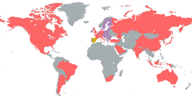
English: G20 map updated |
| मिति | |
| स्रोत | मेरो आफ्नै कार्य |
| लेखक | NaviNews |
अनुज्ञा प्राप्त गर्दै
I, the copyright holder of this work, hereby publish it under the following license:
This file is licensed under the Creative Commons Attribution-Share Alike 4.0 International license.
- तपाईं स्वतन्त्र हुनुहुन्छ :
- साझेदारी गर्नुहाेस् – रचनालाई कपी, वितरित तथा संचारित गर्नको लागि
- रिमिक्स गर्नको लागि – काम अनुकूलित गर्नको लागि
- निम्नलिखित कारणहरूको अन्तर्गत:
- एट्रिब्युसन – तपाईंले रचनाको श्रेय अनुमतिपत्रकर्ता अथवा लेखकले बताएको माध्यमले दिनु पर्नेछ (तर यस प्रकार हैन, जसमा लागोस् की उ तपाईंलाई अथवा तपाईंको रचनाको प्रयोगलाई समर्थन गर्छन्)।
- शेयर अलाइक – यदि तपाई यस रचनामा कुनै परिवर्तन अथवा संसोधन गर्नुहुन्छ या यसमा आधारित केही रचना गर्नुहुन्छ भने तपाई निष्कर्ष स्वरूप बनेको रचनालाई मात्र यहाँ अथवा यसको समान कुनै अनिमति पत्र अन्तर्गत वितरित गर्न सक्नुहुन्छ।
फाइल इतिहास
मिति/समय मा क्लिक गरेर त्यससमयमा यो फाइल कस्तो थियो भनेर हेर्न सकिन्छ ।
| मिति/समय | छोटो चित्र | आकारहरू | प्रयोगकर्ता | टिप्पणी | |
|---|---|---|---|---|---|
| हालको | ०५:५६, ४ नोभेम्बर २०२१ | | ४,७७२×२,५१४ (१.३७ मेगाबाइटहरू) | NaviNews | Uploaded own work with UploadWizard |
फाइल प्रयोग
यस फाइलमा निम्न पृष्ठ जोडिन्छ:
विश्वव्यापी फाइल प्रयोग
निम्न अन्य विकिहरूमा यस फाइलको प्रयोग:
- az.wikipedia.org मा उपयोग
- bs.wikipedia.org मा उपयोग
- en.wikipedia.org मा उपयोग
- es.wikipedia.org मा उपयोग
- it.wikipedia.org मा उपयोग
- ja.wikipedia.org मा उपयोग
- km.wikipedia.org मा उपयोग
- lv.wikipedia.org मा उपयोग
- mk.wikipedia.org मा उपयोग
- my.wikipedia.org मा उपयोग
- sat.wikipedia.org मा उपयोग
- sv.wikipedia.org मा उपयोग
- uz.wikipedia.org मा उपयोग
- vi.wikipedia.org मा उपयोग