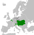
चित्र:Habsburg Monarchy 1789.svg

मूल फाइल (SVG फाइल,साधारण ४५० × ४५६ पिक्सेलहरु, फाइल आकार: ८५७ किलोबाइटहरू)
| यो विकिमीडिया कमन्सको चित्र हो। त्यहाँ यसको विवरण पृष्ठबाट जानकारी तल देखाइएको छ। कमन्स स्वतन्त्र रूपमा इजाजतपत्र प्राप्त चित्र भण्डार हो। तपाईंले मद्दत गर्न सक्नुहुन्छ। |
सारांश
अनुज्ञा प्राप्त गर्दै
- तपाईं स्वतन्त्र हुनुहुन्छ :
- साझेदारी गर्नुहाेस् – रचनालाई कपी, वितरित तथा संचारित गर्नको लागि
- रिमिक्स गर्नको लागि – काम अनुकूलित गर्नको लागि
- निम्नलिखित कारणहरूको अन्तर्गत:
- एट्रिब्युसन – तपाईंले रचनाको श्रेय अनुमतिपत्रकर्ता अथवा लेखकले बताएको माध्यमले दिनु पर्नेछ (तर यस प्रकार हैन, जसमा लागोस् की उ तपाईंलाई अथवा तपाईंको रचनाको प्रयोगलाई समर्थन गर्छन्)।
- शेयर अलाइक – यदि तपाई यस रचनामा कुनै परिवर्तन अथवा संसोधन गर्नुहुन्छ या यसमा आधारित केही रचना गर्नुहुन्छ भने तपाई निष्कर्ष स्वरूप बनेको रचनालाई मात्र यहाँ अथवा यसको समान कुनै अनिमति पत्र अन्तर्गत वितरित गर्न सक्नुहुन्छ।
Original upload log
This image is a derivative work of the following images:
- File:Europe_1789.svg licensed with Cc-by-sa-3.0
- 2013-04-14T01:38:01Z Alphathon 450x456 (853881 Bytes) tweaked again
- 2013-04-14T01:36:10Z Alphathon 450x456 (853881 Bytes) Tweaked Holy Roman Empire border style
- 2013-04-14T01:33:26Z Alphathon 450x456 (853857 Bytes) == {{int:filedesc}} == {{Information |Description={{en|A blank Map of Europe circa 1789. This map also includes a border for the [[:en:Holy Roman Empire|Holy Roman Empire]]. Since there are so many small German states, they h
Uploaded with derivativeFX
Captions
Items portrayed in this file
जनाउँछ
copyright status अङ्ग्रेजी
copyrighted अङ्ग्रेजी
copyright license अङ्ग्रेजी
१४ अप्रिल 2013
data size अङ्ग्रेजी
८७७,४४२ byte
media type अङ्ग्रेजी
image/svg+xml
checksum अङ्ग्रेजी
b6508bc25be786571682da6e714ea356ac7be0c1
फाइल इतिहास
मिति/समय मा क्लिक गरेर त्यससमयमा यो फाइल कस्तो थियो भनेर हेर्न सकिन्छ ।
| मिति/समय | छोटो चित्र | आकारहरू | प्रयोगकर्ता | टिप्पणी | |
|---|---|---|---|---|---|
| हालको | १३:३९, १७ अक्टोबर २०२१ |  | ४५०×४५६ (८५७ किलोबाइटहरू) | Fenn-O-maniC | Fixed the Russo-Swedish border to match the Treaty of Åbo of 1743 |
| ०२:१२, १९ अप्रिल २०१३ |  | ४५०×४५६ (८७७ किलोबाइटहरू) | Alphathon | Style changes | |
| २३:०७, १८ अप्रिल २०१३ |  | ४५०×४५६ (८५६ किलोबाइटहरू) | Alphathon | HRE border | |
| २३:०४, १८ अप्रिल २०१३ |  | ४५०×४५६ (८२० किलोबाइटहरू) | Alphathon | Various fixes | |
| २०:३३, १८ अप्रिल २०१३ |  | ४५०×४५६ (८५३ किलोबाइटहरू) | Alphathon | Fixed Scandinavian borders | |
| ०९:३२, १४ अप्रिल २०१३ |  | ४५०×४५६ (८३९ किलोबाइटहरू) | Alphathon | As main version | |
| ०७:४४, १४ अप्रिल २०१३ |  | ४५०×४५६ (८३१ किलोबाइटहरू) | Alphathon | == {{int:filedesc}} == {{Information |Description={{en|A map of the Habsburg Monarchy circa 1789.}}{{de|Eine Landkarte die Habsburgermonarchie, c. 1989.}} |Source={{Derived from|Europe_1789.svg|disp... |
फाइल प्रयोग
यो फाइलसँग कुनै पनि पृष्ठ जोडिएको छैन।
विश्वव्यापी फाइल प्रयोग
निम्न अन्य विकिहरूमा यस फाइलको प्रयोग:
- cs.wikipedia.org मा उपयोग
- de.wikipedia.org मा उपयोग
- en.wikipedia.org मा उपयोग
- es.wikipedia.org मा उपयोग
- fr.wikipedia.org मा उपयोग
- it.wikipedia.org मा उपयोग
- lt.wikipedia.org मा उपयोग
- pl.wikipedia.org मा उपयोग
- sr.wikipedia.org मा उपयोग
- sv.wikipedia.org मा उपयोग
मेटाडाटा
यस फाइलमा अतिरिक्त जानकारीहरू छन्, यसलाई बनाउन सम्भवतः डिजिटल क्यामरा अथवा स्क्यानर प्रयोग गरिएको हुनुपर्छ । यदि यस फाइललाई मूल अवस्थाबाट परिवर्तन गरिएको हो भने यस फाइलले सम्पूर्ण विवरण प्रतिबिम्बित गर्न सक्नेछैन ।
| छोटो शीर्षक | A map of Habsburg Monarchy within the Holy Roman Empire and Europe ca. 1789 |
|---|---|
| चित्र नाम | A map of the Habsburg Monarchy within the Holy Roman Empire, and within Europe, circa 1789. This map is licensed under the Creative Commons Attribution-Share Alike 3.0 Unported license (https://creativecommons.org/licenses/by-sa/3.0/) by the wikimedia user "Alphathon" (http://commons.wikimedia.org/wiki/User:Alphathon), and is based upon "Blank map of Europe.svg" (http://commons.wikimedia.org/wiki/File:Blank_map_of_Europe.svg), the details of which follow:
A blank Map of Europe. Every country has an id which is its ISO-3166-1-ALPHA2 code in lower case. Members of the EU have a class="eu", countries in europe (which I found turkey to be but russia not) have a class="europe". Certain countries are further subdivided the United Kingdom has gb-gbn for Great Britain and gb-nir for Northern Ireland. Russia is divided into ru-kgd for the Kaliningrad Oblast and ru-main for the Main body of Russia. There is the additional grouping #xb for the "British Islands" (the UK with its Crown Dependencies - Jersey, Guernsey and the Isle of Man) Contributors. Original Image: (http://commons.wikimedia.org/wiki/Image:Europe_countries.svg) Júlio Reis (http://commons.wikimedia.org/wiki/User:Tintazul). Recolouring and tagging with country codes: Marian "maix" Sigler (http://commons.wikimedia.org/wiki/User:Maix) Improved geographical features: http://commons.wikimedia.org/wiki/User:W!B: Updated to reflect dissolution of Serbia & Montenegro: http://commons.wikimedia.org/wiki/User:Zirland Updated to include British Crown Dependencies as seperate entities and regroup them as "British Islands", with some simplifications to the XML and CSS: James Hardy (http://commons.wikimedia.org/wiki/User:MrWeeble) Validated (http://commons.wikimedia.org/wiki/User:CarolSpears) Changed the country code of Serbia to RS per http://en.wikipedia.org/wiki/Serbian_country_codes and the file http://www.iso.org/iso/iso3166_en_code_lists.txt (http://commons.wikimedia.org/wiki/User:TimothyBourke) Uploaded on behalf of User:Checkit, direct complaints to him plox: 'Moved countries out of the "outlines" group, removed "outlines" style class, remove separate style information for Russia' (http://commons.wikimedia.org/wiki/User:Collard) Updated various coastlines and boarders and added various islands not previously shown (details follow). Added Kosovo and Northern Cyprus as disputed territories. Moved major lakes to their own object and added more. List of updated boarders/coastlines: British Isles (+ added Isle of Wight, Skye, various smaller islands), the Netherlands, Germany, Czech Republic, Denmark, Sweden, Finland, Poland, Kaliningrad Oblast of the Russian Federation (and minor tweaks to Lithuania), Ukraine, Moldova (minor), Romania, Bulgaria, Turkey, Greece, F.Y.R. Macedonia, Serbia, Bosnia and Herzegovina, Montenegro, Albania, Croatia, Italy (mainland and Sicily), Malta (http://commons.wikimedia.org/wiki/User:Alphathon). Added Bornholm (http://commons.wikimedia.org/wiki/User:Heb) Released under CreativeCommons Attribution ShareAlike (http://creativecommons.org/licenses/by-sa/2.5/). |
| चौडाइ | 450 |
| उचाई | 456 |
"https://ne.wikipedia.org/wiki/चित्र:Habsburg_Monarchy_1789.svg" बाट अनुप्रेषित


