
चित्र:Java Relief Map.svg

Size of this PNG preview of this SVG file: ८०० × ४२८ पिक्सल. अरु संकल्पहरू: ३२० × १७१ पिक्सल • ६४० × ३४२ पिक्सल • १,०२४ × ५४८ पिक्सल • १,२८० × ६८५ पिक्सल • २,५६० × १,३७० पिक्सल • १,५८७ × ८४९ पिक्सल।
मूल फाइल (SVG फाइल,साधारण १,५८७ × ८४९ पिक्सेलहरु, फाइल आकार: ५.८४ मेगाबाइटहरू)
| यो विकिमीडिया कमन्सको चित्र हो। त्यहाँ यसको विवरण पृष्ठबाट जानकारी तल देखाइएको छ। कमन्स स्वतन्त्र रूपमा इजाजतपत्र प्राप्त चित्र भण्डार हो। तपाईंले मद्दत गर्न सक्नुहुन्छ। |
| वर्णन |
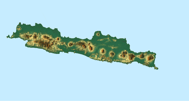
English: Topographic location map of Java, Indonesia
|
| मिति | |
| स्रोत |
मेरो आफ्नै कार्य |
| लेखक | Goran tek-en, following request by Darwinek |
| अनुमति (यो फाइल पुनप्रयोग गर्न) |
This file is licensed under the Creative Commons Attribution-Share Alike 4.0 International license. एट्रिब्युसन: Goran tek-en
|
| SVG genesis |
फाइल इतिहास
मिति/समय मा क्लिक गरेर त्यससमयमा यो फाइल कस्तो थियो भनेर हेर्न सकिन्छ ।
| मिति/समय | छोटो चित्र | आकारहरू | प्रयोगकर्ता | टिप्पणी | |
|---|---|---|---|---|---|
| हालको | ००:१४, १ फेब्रुअरी २०१८ | | १,५८७×८४९ (५.८४ मेगाबाइटहरू) | Goran tek-en | The covering area has been adjusted to fit with File:Indonesia Java location map.svg so they can be used in location template, requested by Joe |
| ०१:१७, ३१ जनवरी २०१८ | १,३००×४१७ (५.८४ मेगाबाइटहरू) | Goran tek-en | {{Information |description ={{en|1=Topographic location map of Java, Indonesia}} |date =20180130 |source ={{Own}}<br> Derived from; * [https://maps-for-free.com/ © OpenStreetMaps contributors], [http://www.openstreetmap.org/cop... |
फाइल प्रयोग
यस फाइलमा निम्न पृष्ठ जोडिन्छ:
विश्वव्यापी फाइल प्रयोग
निम्न अन्य विकिहरूमा यस फाइलको प्रयोग:
- ban.wikipedia.org मा उपयोग
- bcl.wikipedia.org मा उपयोग
- bh.wikipedia.org मा उपयोग
- bn.wikipedia.org मा उपयोग
- ckb.wikipedia.org मा उपयोग
- es.wikipedia.org मा उपयोग
- fa.wikipedia.org मा उपयोग
- hi.wikipedia.org मा उपयोग
- ilo.wikipedia.org मा उपयोग
- ja.wikipedia.org मा उपयोग
- ko.wikipedia.org मा उपयोग
- lo.wikipedia.org मा उपयोग
यस फाइलको विश्वव्यापी उपयोगको अधिक जानकारी हेर्नुहोस् ।