
चित्र:LocationAnguilla.png
उच्च रिजोल्युशन अनुपलब्ध
LocationAnguilla.png (२५० × ११५ पिक्सेलहरू, फाइल आकार: ५ किलोबाइटहरू, MIME प्रकार: image/png)
| यो विकिमीडिया कमन्सको चित्र हो। त्यहाँ यसको विवरण पृष्ठबाट जानकारी तल देखाइएको छ। कमन्स स्वतन्त्र रूपमा इजाजतपत्र प्राप्त चित्र भण्डार हो। तपाईंले मद्दत गर्न सक्नुहुन्छ। |
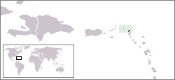
Country locator map - Anguilla
This country locator map was created by Vardion and is released into the public domain.
| This work has been released into the public domain by its author, Vardion at अङ्ग्रेजी विकिपीडिया. This applies worldwide. In some countries this may not be legally possible; if so: Vardion grants anyone the right to use this work for any purpose, without any conditions, unless such conditions are required by law. |
फाइल इतिहास
मिति/समय मा क्लिक गरेर त्यससमयमा यो फाइल कस्तो थियो भनेर हेर्न सकिन्छ ।
| मिति/समय | छोटो चित्र | आकारहरू | प्रयोगकर्ता | टिप्पणी | |
|---|---|---|---|---|---|
| हालको | १६:५४, १४ फेब्रुअरी २००५ | | २५०×११५ (५ किलोबाइटहरू) | Knutux | Country locator map - Anguilla |
फाइल प्रयोग
यस फाइलमा निम्न पृष्ठ जोडिन्छ:
विश्वव्यापी फाइल प्रयोग
निम्न अन्य विकिहरूमा यस फाइलको प्रयोग:
- ar.wikipedia.org मा उपयोग
- arz.wikipedia.org मा उपयोग
- azb.wikipedia.org मा उपयोग
- az.wiktionary.org मा उपयोग
- ba.wikipedia.org मा उपयोग
- be-tarask.wikipedia.org मा उपयोग
- be.wikipedia.org मा उपयोग
- bg.wikipedia.org मा उपयोग
- bpy.wikipedia.org मा उपयोग
- bs.wikipedia.org मा उपयोग
- chr.wikipedia.org मा उपयोग
- de.wikivoyage.org मा उपयोग
- de.wiktionary.org मा उपयोग
- dsb.wikipedia.org मा उपयोग
- el.wikipedia.org मा उपयोग
- en.wikipedia.org मा उपयोग
- en.wikivoyage.org मा उपयोग
- eo.wikipedia.org मा उपयोग
- fi.wikivoyage.org मा उपयोग
- fr.wiktionary.org मा उपयोग
- he.wikivoyage.org मा उपयोग
- hr.wikipedia.org मा उपयोग
- hu.wikipedia.org मा उपयोग
- hu.wikinews.org मा उपयोग
- ilo.wikipedia.org मा उपयोग
- incubator.wikimedia.org मा उपयोग
- it.wikivoyage.org मा उपयोग
- jam.wikipedia.org मा उपयोग
- ja.wikipedia.org मा उपयोग
- jv.wikipedia.org मा उपयोग
- ka.wikipedia.org मा उपयोग
- ko.wiktionary.org मा उपयोग
- kw.wikipedia.org मा उपयोग
- lij.wikipedia.org मा उपयोग
- li.wikipedia.org मा उपयोग
- lmo.wikipedia.org मा उपयोग
- lt.wikipedia.org मा उपयोग
- lt.wiktionary.org मा उपयोग
- lv.wikipedia.org मा उपयोग
- mk.wikipedia.org मा उपयोग
यस फाइलको विश्वव्यापी उपयोगको अधिक जानकारी हेर्नुहोस् ।