
चित्र:Sulphur Tornado Radar Image.png
यस पूर्व रुपको आकार: ८०० × ३९४ पिक्सल। अरु संकल्पहरू: ३२० × १५८ पिक्सल • ६४० × ३१५ पिक्सल • १,०२४ × ५०५ पिक्सल • १,२८० × ६३१ पिक्सल • २,३२२ × १,१४४ पिक्सल।
मूल फाइल (२,३२२ × १,१४४ पिक्सेलहरू, फाइल आकार: ५.०३ मेगाबाइटहरू, MIME प्रकार: image/png)
| यो विकिमीडिया कमन्सको चित्र हो। त्यहाँ यसको विवरण पृष्ठबाट जानकारी तल देखाइएको छ। कमन्स स्वतन्त्र रूपमा इजाजतपत्र प्राप्त चित्र भण्डार हो। तपाईंले मद्दत गर्न सक्नुहुन्छ। |
सारांश
| वर्णन |
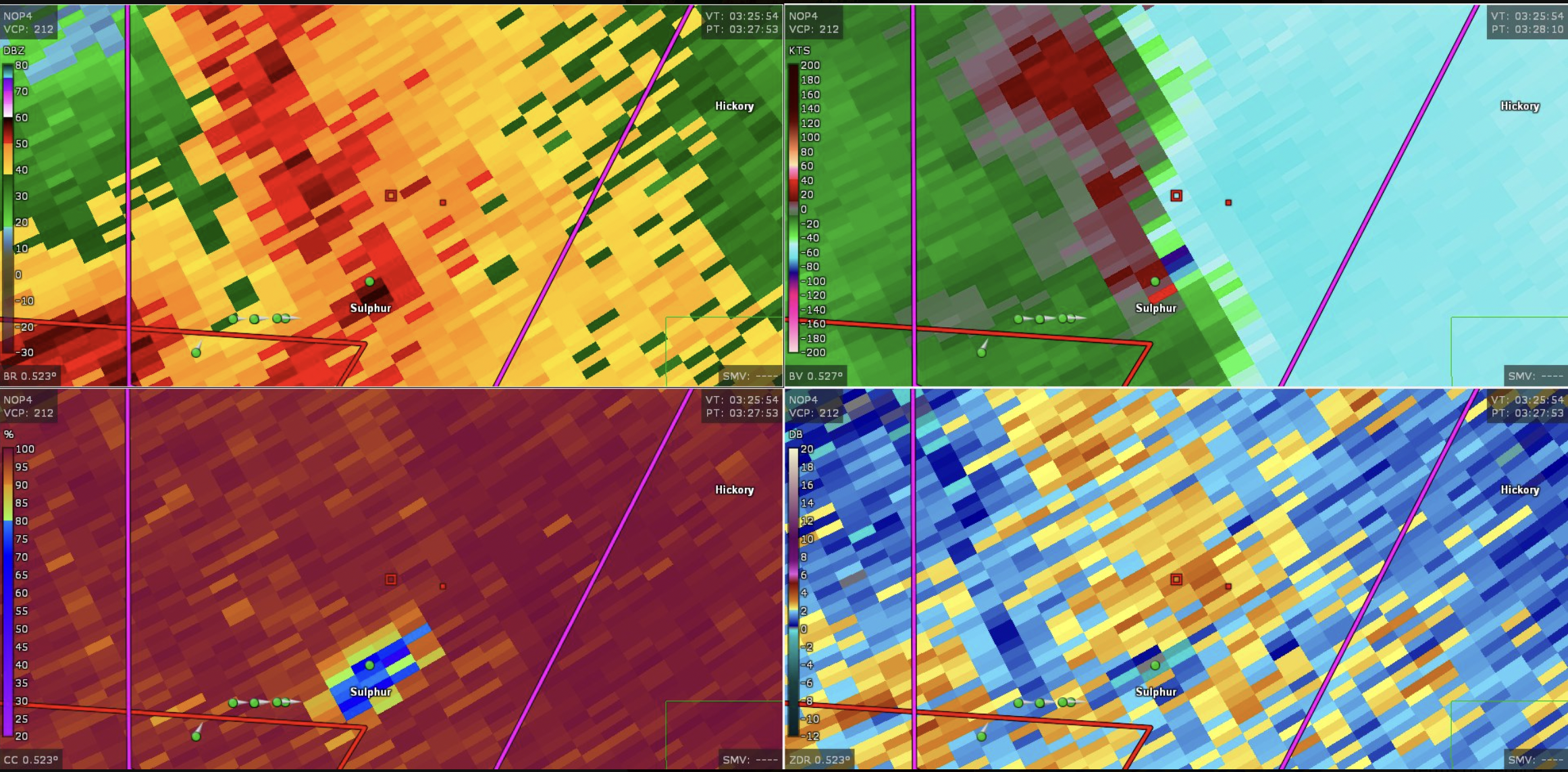
English: This image shows the radar presentation of a damaging tornado in Sulphu,r Oklahoma on April 27, 2024. |
| मिति | |
| स्रोत | NEXRAD |
| लेखक | National Weather Service, Federal Aviation Administration, United States Air Force |
अनुज्ञा प्राप्त गर्दै
This image is in the public domain because it is from one or more of the U.S. government’s 159 NEXRAD radars, which are jointly owned and operated by the National Weather Service (NWS), an agency of the National Oceanic and Atmospheric Administration (NOAA) within the United States Department of Commerce, the Federal Aviation Administration (FAA) within the Department of Transportation, and the U.S. Air Force within the Department of Defense.
Thus all NEXRAD images are public domain.
|
  |
फाइल इतिहास
मिति/समय मा क्लिक गरेर त्यससमयमा यो फाइल कस्तो थियो भनेर हेर्न सकिन्छ ।
| मिति/समय | छोटो चित्र | आकारहरू | प्रयोगकर्ता | टिप्पणी | |
|---|---|---|---|---|---|
| हालको | ०१:२९, २९ अप्रिल २०२४ | | २,३२२×१,१४४ (५.०३ मेगाबाइटहरू) | Floriangkmcc | Uploaded a work by The National Weather Service from Nexrad Radar with UploadWizard |
फाइल प्रयोग
यो फाइलसँग कुनै पनि पृष्ठ जोडिएको छैन।