
चित्र:Sohail Gate Plan.jpg

मूल फाइल (६०० × ८०० पिक्सेलहरू, फाइल आकार: ४३ किलोबाइटहरू, MIME प्रकार: image/jpeg)
| यो विकिमीडिया कमन्सको चित्र हो। त्यहाँ यसको विवरण पृष्ठबाट जानकारी तल देखाइएको छ। कमन्स स्वतन्त्र रूपमा इजाजतपत्र प्राप्त चित्र भण्डार हो। तपाईंले मद्दत गर्न सक्नुहुन्छ। |
सारांश
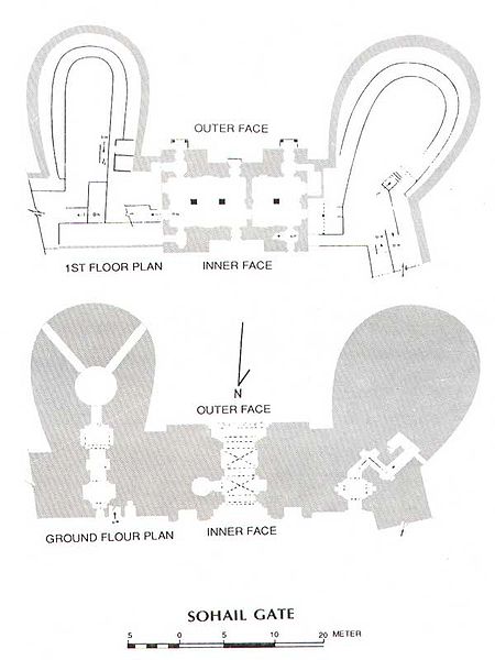
mistype in comment. The image is from Architectural Survey of India maps. It was first drawn in "Annual Report of Archaelogical Survey of India: 1922-23: Delhi". After 1947(Pakistan) it has been in public domain and been freely used in many books including the one i quoted in the reference.
अनुज्ञा प्राप्त गर्दै
|
This work is in the public domain in its country of origin and other countries and areas where the copyright term is the author's life plus 70 years or fewer.
| |
| This file has been identified as being free of known restrictions under copyright law, including all related and neighboring rights. | |
फाइल इतिहास
मिति/समय मा क्लिक गरेर त्यससमयमा यो फाइल कस्तो थियो भनेर हेर्न सकिन्छ ।
| मिति/समय | छोटो चित्र | आकारहरू | प्रयोगकर्ता | टिप्पणी | |
|---|---|---|---|---|---|
| हालको | ०२:५७, २४ डिसेम्बर २००६ | | ६००×८०० (४३ किलोबाइटहरू) | Omar mukhtar~commonswiki |
फाइल प्रयोग
यस फाइलमा निम्न पृष्ठ जोडिन्छ:
विश्वव्यापी फाइल प्रयोग
निम्न अन्य विकिहरूमा यस फाइलको प्रयोग:
- it.wikipedia.org मा उपयोग
- ja.wikipedia.org मा उपयोग